Skip to content

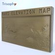
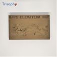
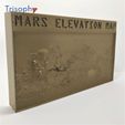
MARS ELEVATION MAP

Advertising
Advertising
?
Creation quality: 5.0/5 (1 vote)
Evaluation of members on the printability, utility, level of detail, etc.

  • 2.8k views
  • 4 likes
  • 6 downloads

License
3D design format
PDF and ZIP Folder details Close
  • D_FILE_MARS_E_M_Trisophy.zip
  • Readme Trisophy customer.pdf

Learn more about the formats

Last update 2020-10-29 at 13:28
Publication date 2020-10-11 at 15:59
Design number 211229

3D printer file info

3D model description

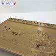
You can find easily the Olympus Mons and the Valles Marineris but there is a lot of other interesting points to identify on the map while you explore the mars surface.
This map presents the entire Mars surface and you can identify the prominent geographic features. Elevation is exaggerated to make visible the features and even touch and feel the mars surface.
Elevation data it is based on information available on USGS Astrogeology Science Center using the digital elevation model (DEM) data derived from the Mars Orbiter Laser Altimeter (MOLA), an instrument aboard NASA’s Mars Global Surveyor spacecraft (MGS), and the High-Resolution Stereo Camera (HRSC), an instrument aboard the European Space Agency’s Mars Express (MEX) spacecraft.
You can find all the details in the following link:
https://astrogeology.usgs.gov/search/map/Mars/Topography/HRSC_MOLA_Blend/Mars_HRSC_MOLA_BlendDEM_Global_200mp
Model it is created with tool.itslitho.com

3D printing settings

Printing features:
The model dimensions are 200mm long. Stl model has great detail to be escalated as you wish. In case you reduce the scale some details can disappear.
In order to be easy printing and maintain the detail this model is designed to be printed vertical.
Two very thin columns in the model ends to stabilize during printing, also maintain the model vertical for display and can removed in case you want to glue the model to any surface or hang on the wall using pocket for nail in the model back.
You can print the model in any color and the details are visible. In case you want to illuminate from the back a 100% infill and clear filament should be used
This map model can be printed with a standard 200x200mm and 0.4 mm nozzle 3d printer

Advertising


Issue with this design? Report a problem.

Would you like to support Cults?

You like Cults and you want to help us continue the adventure independently? Please note that we are a small team of 3 people, therefore it is very simple to support us to maintain the activity and create future developments. Here are 4 solutions accessible to all:

  • ADVERTISING: Disable your banner blocker (AdBlock, …) and click on our banner ads.

  • AFFILIATION: Make your purchases online by clicking on our affiliate links here Amazon.

  • DONATE: If you want, you can make a donation via Ko-Fi 💜.

  • WORD OF MOUTH: Invite your friends to come, discover the platform and the magnificent 3D files shared by the community!


Sharing and downloading on Cults3D guarantees that designs remain in makers community hands! And not in the hands of the 3D printing or software giants who own the competing platforms and exploit the designs for their own commercial interests.

Cults3D is an independent, self-financed site that is not accountable to any investor or brand. Almost all of the site's revenues are paid back to the platform's makers. The content published on the site serves only the interests of its authors and not those of 3D printer brands who also wish to control the 3D modeling market.
100% secure payment by credit card, PayPal, Apple Pay, Google Pay, etc.
View all payment options.